Reading time: 7 minutes
This perception almost inevitably, leads to the wrong guiding question: „How can my building be captured as a complete, millimeter-accurate digital replica?"
This question is misleading because it confuses the goal with the maximum. The right question is: „How much digital information do I actually need — and what for?"
Every digitalization measure stands or falls with clarity about its purpose. Method, level of detail, and data volume follow from the intended use — not from what is technically feasible.
Four paths to a digital copy — and what they cost
Four methods for surveying existing buildings have become established, and they differ by orders of magnitude in effort, cost, and accuracy. A blanket recommendation is therefore impossible. The right method follows from the use case, not from the state of the art.
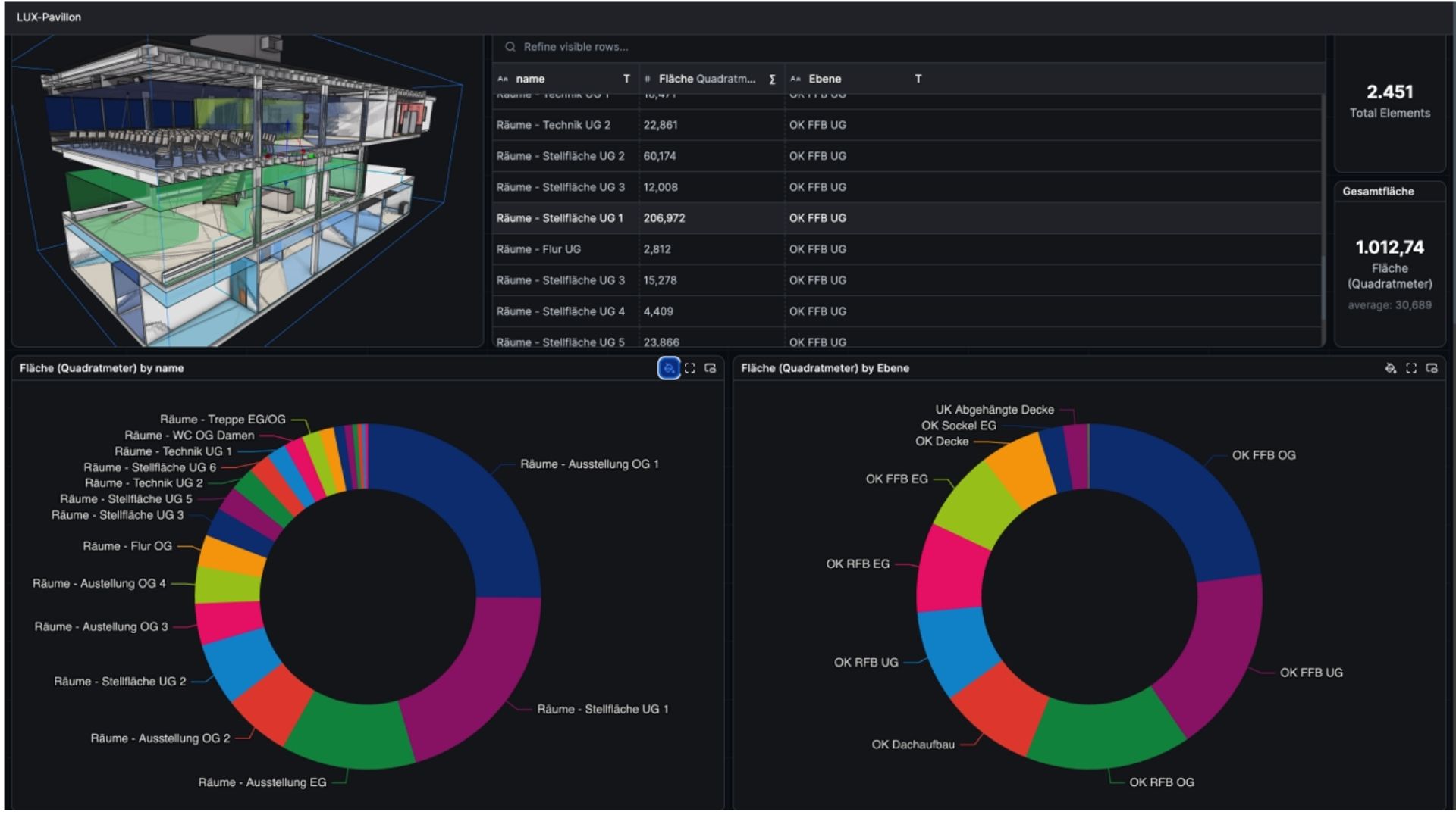
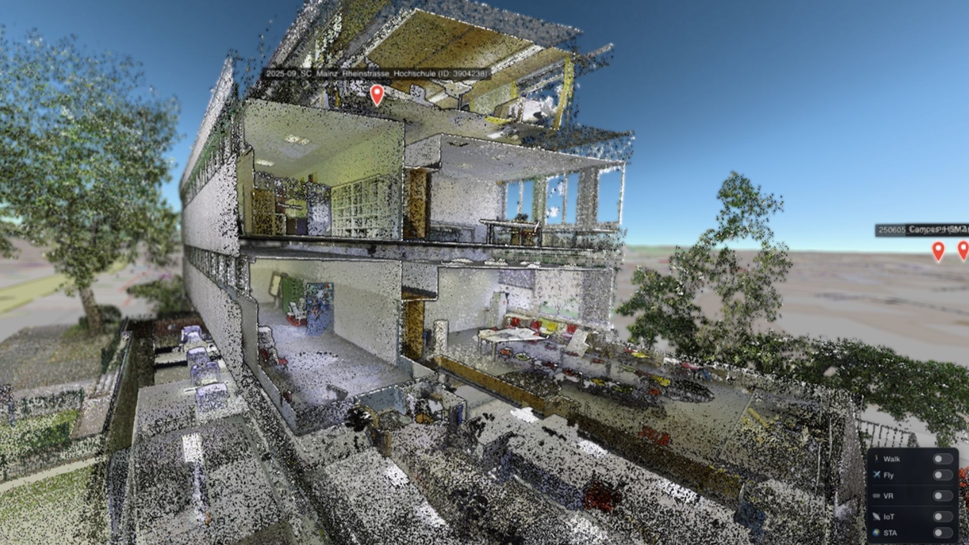
Image: Dashboard of the digital twin of the Lux Pavilion at HS Mainz
Method 1: The Smartphone
A modern smartphone with a built-in Li-DAR sensor — as found in current iPhone Pro or iPad Pro models — can capture a room in three dimensions within minutes. LiDAR stands for Light Detection and Ranging: light pulses are emitted and their reflections measured to compute distances to the sender/receiver. The de-vice is moved continuously while internal algorithms and the inertial measurement unit (IMU) calculate its relative position. The result is not a high-precision survey, but a usable geometric basis — rough room dimensions, wall outlines, and a first floor-plan representation. For many everyday tasks this is entirely sufficient.
- Accuracy: ± 10–30 mm
- Time required: Minutes
- Data volume: Small (50–200 MB)
- Cost: Device usually already on hand
- Suitable for: Rapid surveying, furniture planning, initial spatial orientation.
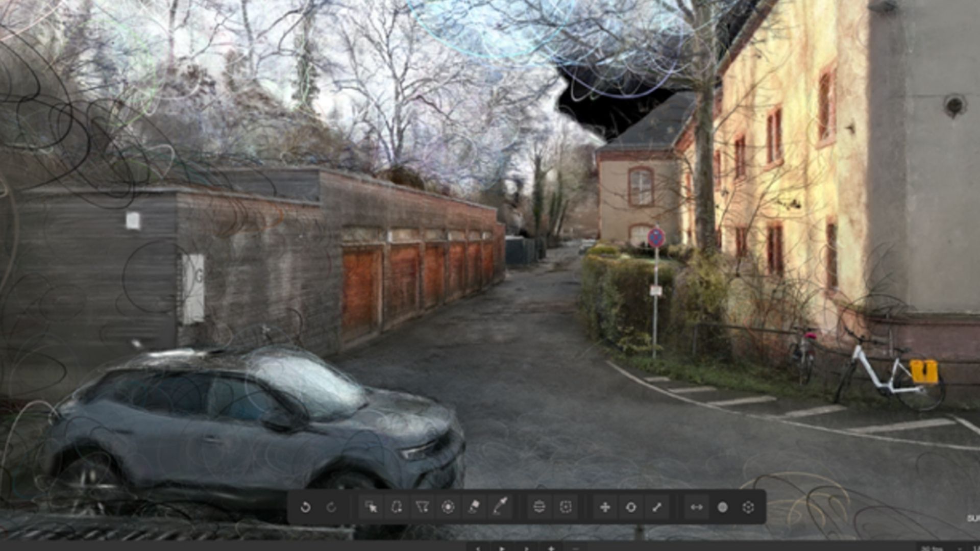
Method 2: Gaussian Splatting - photorealistic, but not accurate
Gaussian Splatting is a method whose effect is striking at first sight. A short video of a room or building captured with a smartphone is enough to generate an interactive, photorealistic 3D representation. You can then move virtually through the building with an impression of spatial precision.
And this is exactly where the decisive limitation lies. What looks photorealistic is not geometrically reliable. Door widths, room heights, and wall thicknesses cannot be reliably read from such a model. Gaussian Splatting produces a visual representation, not a metric statement — comparable to a very good panoramic photo that shows everything but provides no reliable measurements. It is therefore unsuitable for planning or structural engineering tasks.
- Accuracy: Visual, not metric (1–3 cm with LiDAR-SLAM augmentation)
- Time required: Capture: minutes / Processing: hours
- Data volume: Low to medium (500 MB – 3 GB)
- Cost: Very low
- Suitable for: Virtual walkthroughs, training, remote inspection, public communication.
- Not suitable for: Renovation planning, structural engineering, or any task requiring precise measurements.
Current developments in this method clearly show its potential. New compression techniques already enable nearly lossless data reductions of more than 90 percent over previous formats. PlayCanvas's newly developed compression method spacially ordered gaussians, or .sog for short, can already achieve 10-15 times compression with minimal losses.
Method 3: Mobile LiDAR Scanner (SLAM)
Unlike classic tripod-mounted devices, mobile laser scanners are carried while walking through the building. The underlying procedure is called SLAM, short for Simultaneous Localization and Mapping: the scanner continuously captures its surroundings via laser beam while deter-mining its own position in space from distinctive features and sensor data. From this ongoing alignment, a so-called point cloud emerges in real time — a three-dimensional collection of millions of individual measurement points that together describe the building's geometry.
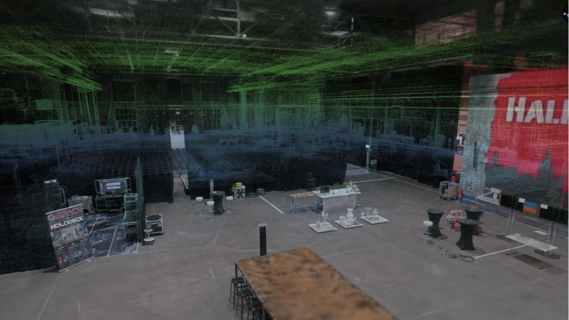
An entire floor can be documented this way in roughly 30 minutes. From the point cloud, floor plans can be derived, room areas calculated, and simple BIM models created. The time-consuming setup of tripods is eliminated entirely, which significantly speeds up capture, especially in complex building structures.
- Accuracy: ± 5–15 mm
- Time required : Hours
- Data volume: Large (5–50 GB per building)
- Cost: Equipment rental or service provider (€500–3,000/day)
- Suitable for: Full building surveys, floor-plan derivation, simple BIM models.
Method 4: The gold standard - terrestrial laser scanning (TLS)
Terrestrial laser scanning with a tripod-mounted device — manufacturers such as Leica, FARO Zoller und Fröhlich, or Riegl set the benchmark — is the reference for surveying existing buildings. An accuracy of one to three millimeters makes this method indispensable for ren-ovation planning, structural calculations, and legally valid documentation.
The price of this precision is considerable. Capture is time-intensive and quickly stretches over several days, the resulting data volumes are immense, and the effort for processing and downstream modeling often exceeds the pure capture effort it-self.
- Accuracy: ± 1–3 mm
- Time required: Days to weeks
- Data volume: Very large (50–500 GB, easily into the terabyte range)
- Cost: €1,000–10,000 per capture day
- Acquisition cost: Approx. €50,000
- Suitable for: Renovation planning, structural engineering, BIM per ISO 19650, construction documentation.
The underestimated factor: Data volume
One aspect that receives too little attention in the technical discussion around building digitalization is the sheer volume of data produced by high-precision building scans. To illustrate:
- A medium-sized five-story office building generates 50 to 200 gigabytes of raw scan data.
- For historic buildings with irregular or complex geometry it can be 300 giga-bytes or more.
Subsequent processing — registration, cleanup, and modeling for BIM software — doubles or triples this volume again.
This data must be stored, backed up, transferred, and processed by appropriately qualified personnel — and, above all, visualized. For a municipal administration, a school, or a mid-sized business, this represents an IT challenge whose full scope is typically only grasped during the course of the project.
Processing a comprehensive laser scan by an experienced BIM modeler can take weeks to months. The result is then a high-precision model that, in everyday building operation, is often used at only a fraction of its capabilities. Because of their parametric CAD structure, BIM models are very efficient in terms of file size. At the same time, classic BIM models are often visually unappealing because they cannot represent surface quality. For inspections on the model — for example in structural health monitoring of bridges — surface quality is essential. A combination of BIM model and scan is therefore the method of choice to maximize usability and to make even small cracks visible.
Storage space may not look expensive at first glance. But hosting and providing cloud servers or one's own infrastructure can quickly add up significantly over the lifetime of a project — and the cost of the end devices needed to display such massive datasets should not be neglected either.
BIM is not a model — BIM is a method
A widespread misconception is to equate BIM with the 3D model itself. In fact, BIM denotes neither a technology nor a specific file format, but a working method for information management — the structured provision, management, and use of building information across the entire lifecycle of a structure, from design through operation to demolition.
It follows that a BIM model for facility operation does not need to be complete — it needs to be fit for purpose. The focus belongs on the information content: the LOIN (Level of Information Need). The 3D model serves more as a map to locate assets and to create an intuitive under-standing of the building and its function. The quality of a model is not measured by its level of detail, but by whether it answers the questions for which it was created.
Three questions should therefore stand at the beginning of every digitalization initiative:
- Who is the data intended for (Facility managers, planning offices, authorities, the public)?
- What will it be used for in concrete terms (Renovation planning, day-to-day operation, communication, emergency management)?
- Over what period should it be kept up to date (One-off survey, annual update, or continuous maintenance)?
From Gaussian Splatting to the digital twin
The Scan2BIM4FM concept developed at the BIM.Labor and Smart Building Real Labor of HS Mainz follows a pragmatic, step-wise approach. Rather than aiming for a complete BIM model from the outset, the level of digitalization is matched to actual demand and expanded incrementally as that demand grows. This strategic approach distinguishes five stages:
- Stage 1 — Visual: A scan using smartphone LiDAR, photogrammetry, or Gaussian Splatting pro-vides immediate spatial orientation with minimal effort and no specialist expertise required.
- Stage 2 — Spatial: A mobile scanner captures floor plans and room areas — the basis for computer-aided facility management (CAFM).
- Stage 3 — Building services: Technical installations such as heating, ventilation, and electrical systems are captured and linked to the model.
- Stage 4 — Live: Sensors measure temperature, occupancy, or energy consumption in real time and continuously feed this data into the model — the so-called digital twin emerges.
- Stage 5 — Precision: Only at this stage does the high-precision laser scan come into play — and only where renovation planning or legal requirements actually justify the effort.
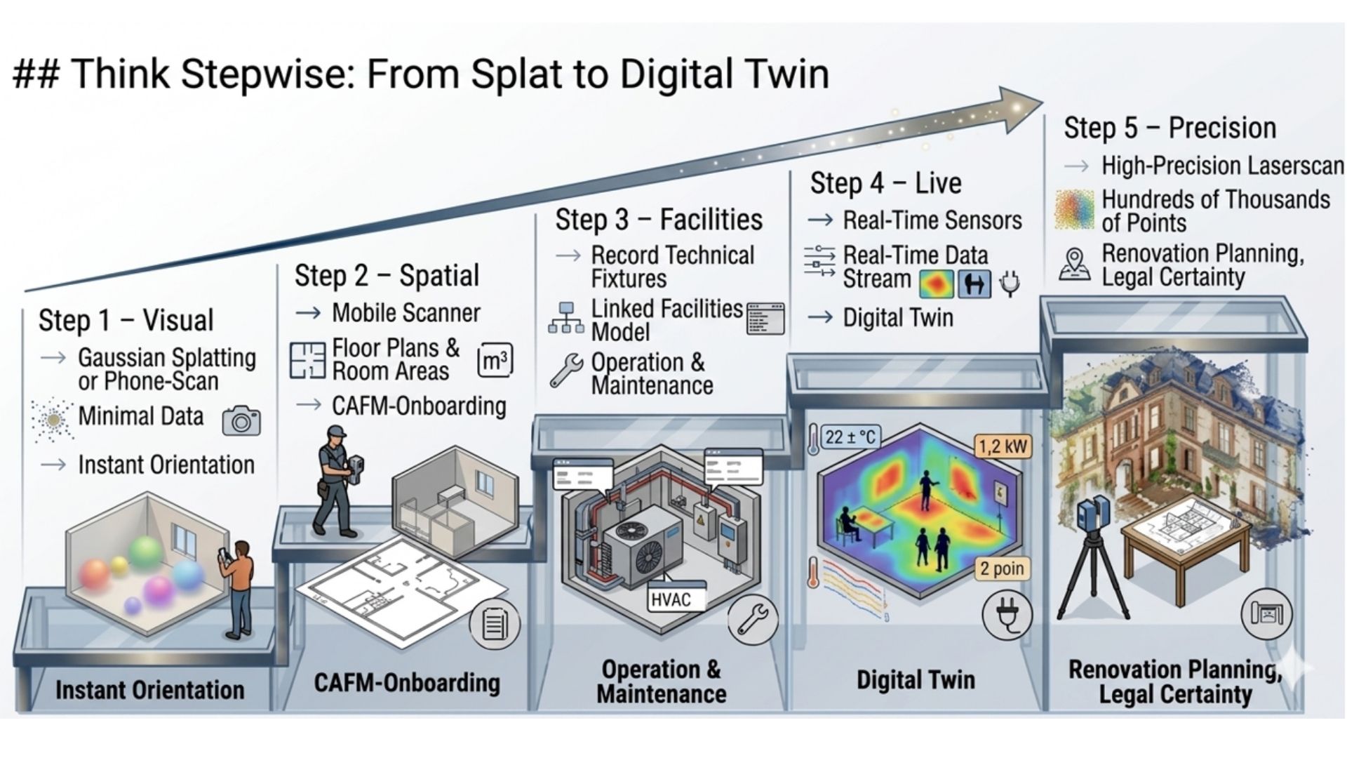
Image: Staircase diagram of the five stages of the Scan2BIM4FM concept
Conclusion: Don't maximize — capture with purpose
Digitalizing buildings is not an end in it-self, nor a contest for the largest data volume. It is a tool — and tools are chosen according to the task, not according to their capability. It must also always be kept in mind that, in the case of renovations, extensions, or maintenance work, models have to be maintained and updated by the trades and facility managers. In reality, however, one regularly hits the limits of what is feasible. Facility managers are usually not trained in surveying or 3D design. The shortage of skilled labor often forces us into pragmatic solutions.
Not every building needs the same kind of digital capture. Especially for municipalities, educational institutions, and mid-sized organizations, the rule is: a pragmatic entry with simple methods creates immediate benefit — without overburdened IT, without months of planning, and without effort that is only justified and necessary on large projects with complex on-site conditions.
The decisive question is not what is technically possible, but what is actually needed. BIM as you need: no more — but no less either.